Lakes Huron/Michigan could see 3.5 foot drop below record low levels by 2030: study
Sept 13, 2022
By Lori Thompson, Local Journalism Initiative Reporter, The Manitoulin Expositor
A study on water levels projects an unprecedented drop of water levels on Lakes Michigan-Huron and Georgian Bay to 1.1 metres (3.5 feet) below the record low by 2030. By 2040, levels may rise to 0.3 metres (one foot) higher than the 1986 record high. The study by W.F. Baird & Associates Coastal Engineers Ltd. was commissioned by the Georgian Bay Great Lakes Foundation (GBGLF) and was shared virtually by GBGLF on May 16/17. The Baird conclusions are essentially the same as those found in a recently completed five-year study by Environment and Climate Change Canada (ECCC), presented during a week-long Great Lakes Coastal Wetlands webinar series from April 4 to 8.
Bill Bialkowski is a director-at-large for GBGLF and a retired professional engineer with experience in the mathematical modeling of hydraulic systems. He spent 15 years analyzing and modeling Upper Great Lakes hydrology and the conveyance capacity of the St. Clair River. He presented his analysis of water levels and the impact of climate change as was presented by ECCC’s Dr. Frank Seglenieks, lead author for ECCC.
The ECCC study predicts that all Great Lake levels will generally trend upwards, with increasing variability. Lake Michigan-Huron currently has, by far, the widest range between high water and low water levels of all Great Lakes, at 6.3 feet. The study suggests that this may go to 13 feet. By 2040, Lake Michigan-Huron is likely to face water levels as high as 177.8 (one foot higher than the 1986 record high). Worst of all, Mr. Bialkowski said, by 2030, which is only eight years away, Lake Michigan-Huron is projected to drop to 174.5 (3.5 feet lower than 2000 lows). “It may become possible to walk to many islands,” he said.
The Baird report (Prediction of Lake Levels on Lakes Michigan-Huron and Erie) was presented by Rob Nairn, a professional engineer with Baird. The ECCC method used numerical models (Global Circulation Models and downscaling with Weather Research and Forecasting Model [wrF]) that are very complex and not necessarily designed for the Great Lakes, Mr. Nairn said. Other organizations, including the United States Army Core of Engineers (USACE), the National Oceanic and Atmospheric Administration (NOAA) and the United States Geological Survey (USGS) are currently working on a similar assessment, due to be completed in 2023/2024.
“These models do not necessarily consider, or have not been shown to predict, the cyclical nature of the Great Lakes water levels,” Mr. Nairn said. He doesn’t believe the global climate change models were ever designed or intended to be scaled down to an area the size of the Great Lakes. “Our approach is empirical and is based on observing intelligible patterns and linking those patterns to know the cyclic behaviour of climate (but does not include climate change).”
The prediction model was developed using harmonic analysis to determine the major driving cycles for Great Lakes fluctuations and was calibrated using monthly average lake level data from 1860 to 2019. Predictions may have phase errors of +/- five years.
“We successfully predicted approximately 10 years of low lake levels on Lake Erie (2005 to 2015),” Mr. Nairn said. “We successfully predicted the rapid decline of Michigan-Huron that we are currently experiencing, but one year late.”
Using this same method (which does not consider anthropogenically induced climate change), a period of low lake levels is predicted for the next 20 years or longer on Michigan-Huron.
“ECCC has not released the actual documents with the data of how they arrived at these conclusions,” Mary Muter, chair of GBGLF, told The Expositor. “They’re saying they won’t be released until late August. It is highly unusual to present findings such as he did but not provide the background document upon which his presentation was based. That’s a concern.”
But she wasn’t so much concerned with what ECCC said as with what they didn’t say. “They presented those findings with absolutely no discussion whatsoever on what the implications are,” she said.
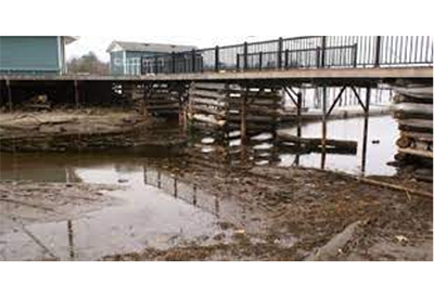
Those who live around the Great Lakes understand what three-and-one-half feet lower means: dried up wetlands, municipal infrastructure concerns, fisheries impacts, and warmer water temperatures to start.
“I can’t remember what the docks are like at Little Current but the docks at Parry Sound, Midland, Penetang and Collingwood are all fixed, large concrete piers. They cannot be lowered,” she said. “I’m not even sure that there will be enough water at some of them to be able to access (the docks) at three-and-a-half feet lower,” she said. Obviously, there are implications for the Chi-Cheemaun ferry that travels between Tobermory and Manitoulin Island.
“The wetlands drying up will affect the recreational fishery big time. They’re the nursery habitat for all the young fish. What’s that going to do to recreational fishing all across the Great Lakes, not just Georgian Bay?” she asked.
ECCC concluded that Georgian Bay wetlands will be able to be resilient while facing climate change, Ms. Muter said, but “They only went to a few wetlands.” She took a group into a Canadian Shield/Georgian Bay wetland but they didn’t collect depth information to create a bathymetry profile for the area, choosing to rely on LIDAR data instead.
Canadian Hydrographic Services arranged to have LIDAR imagery collected all along the Canadian coastline of the Great Lakes, but it was only after the work was done and the imagery provided to ECCC did they find out the LIDAR was unable to read through the dense wetland vegetation, Ms. Muter added. “So they had no depth information for the wetland they spent several days assessing. They scrapped that site. It’s not included in this work.”
“They said the wetlands in Lake Erie are vulnerable to climate change. Well, I know enough about it to know that the wetlands in Georgian Bay are also very vulnerable, especially facing a range of (water) levels going to 13 feet from 6’4”.”
The impacts are much greater for Lakes Michigan-Huron and Georgian Bay because the other lakes are regulated. “They’ll be able to hold back water during low supply situations,” Ms. Muter explained. “The Lake Superior control board will dump excess water out during periods of high supply. They’re implying we’re going from the six-foot-four range that we currently have, that’s beyond what any of the other Great Lakes have, to going to a 13 foot range, without even commenting and saying something should be done about this. Shouldn’t we figure out a way to control water levels to some extent for the middle Great Lakes?”
GBGLF said the projected high values make it imperative for the International Joint Commission (IJC) to revisit means of reducing Lake Michigan-Huron high levels including minimizing the Long Lac and Ogoki diversions into Lake Superior, improving revisiting the potential for a temporary increase in the Chicago diversion out of Lake Michigan.
However, the 2030 low water projection means it’s even more imperative to collect proper bathymetric data of the St. Clair River and to design flexible compensation structures for the St. Clair River’s in order to minimize low levels, Mr. Bialkowski pointed out. “A three-dimensional hydraulic model of the river is needed to allow the design of the flexible structures to hold back water during low water periods, while ensuring no impact on high water.”
“The USACE has collected bathymetric data, and we’re waiting and hoping that they collect data they consider valid, that they can share with us and then we will be able to pay Baird to run that,” Ms. Muter said. “In the meantime, you need hydraulic control engineers working on designs. In the webinar, you heard what Bill Bialkowski’s research has determined to be the best methods. He consulted with NASA to get the most dynamic shape that would not provide any resistance to the flow, and he even consulted with the coastal flooding engineers at Wood’s Hole, which is a big US research facility. We have control gates and locks in the St. Mary’s River and in this day and age, we can’t figure out a better way than just let the St. Clair River erode? It’s just unconscionable.”
Locks and control gates in the St. Mary’s River have been there since the 1930s. They were designed for the St. Clair River when the Seaway was designed, but never built. “We’re not proponents or supporters of locks and control gates,” she said. “We do not think that’s needed in the St. Clair River, but we need much better management of the water levels.”
It’s less than eight years now until 2030. “This is an urgent issue that nobody’s paying attention to,” Ms. Muter said. “You can imagine this will require binational cooperation and bi-national funding. The work to determine the best method needs to be done right now. I can imagine it will take several years to complete the project. Technically, this is a challenging, high flow river. I’ve spoken to the USACE. They know it’s doable. But it will cost a lot of money and it will take time. How bad do we want it to get? That’s the only question.”
– Reprinted courtesy the author and The Manitoulin Expositor