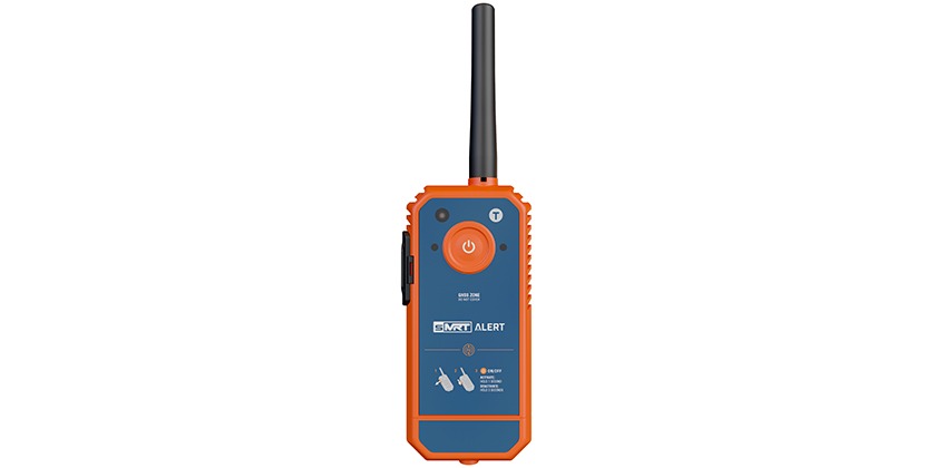
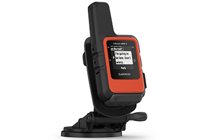
Stay connected for up to 30 days with the inReach Mini 2 Marine Bundle from Garmin
Sept 26, 2022
Garmin International, Inc., a unit of Garmin Ltd. (NYSE: GRMN), has announced the inReach® Mini 2 Marine Bundle, a satellite communication device with two-way messaging and SOS capabilities1 bundled with a boat-friendly mount that provides quick-and-easy access in a moment’s notice. Rugged, compact and purpose-built for life off the grid, the inReach Mini 2 comes packed with features that give mariners an added sense of security on the water such as two-way text messaging, location tracking and weather updates thanks to the global Iridium® satellite network. In an emergency, inReach Mini 2 users can trigger an interactive SOS message to the Garmin International Emergency Response Coordination Center (IERCC), a 24/7 staffed professional emergency response coordination center.
“When performance and reliability are needed most, the inReach Mini 2 helps boaters, anglers and sailors stay connected to loved ones when their explorations take them outside of cellphone range,” said Dan Bartel, Garmin vice president of global consumer sales. “The best plan is to always be prepared, which is why Garmin satellite communicators have become trusted tools for anyone leaving the dock. With its compact size, robust location features and long-lasting battery life, the inReach Mini 2 is an invaluable companion for any boating adventure.”
Optimized for life on the water
Small but mighty, the inReach Mini 2 measures 4 inches tall and 2 inches wide, weighing a mere 3.5 ounces, and yet it encompasses it all—from messaging to tracking to declaring an SOS. Water-rated to IPX72, it can be paired with compatible marine electronics on board, including the GPSMAP® 8400/8600 Series and GPSMAP 7×3/9×3/12×3 Series chartplotters, quatix® 7 Series marine GPS smartwatches and more, or used freely on its own. Wireless unit-to-unit connectivity lets users remotely control the inReach Mini 2 to send and receive messages, start and stop tracking and, in the event of an emergency, trigger an interactive SOS directly from the paired device. For added peace of mind without taking up valuable space at the helm, mariners can securely mount the inReach Mini 2 and keep it charged in a convenient location thanks to the included screw-down mount and 12-volt power cable.
Enduring battery life
Whether at sea or back on land, inReach Mini 2 users can explore longer knowing their device features up to 14 days of continuous run time in default 10-minute tracking mode. To further extend battery-life, tracking intervals can be customized to provide up to 30 days of continuous use when in 30-minute tracking mode3. Mariners who find themselves only occasionally off the grid will feel confident knowing the inReach Mini 2 can remain charged and ready for use when powered off for up to one year, making it a valuable addition to any emergency kit.
Adventure-ready companion
The inReach Mini 2 automatically records activities and passively stores routes traveled. Should a user get lost, they can simply engage TracBack® and an on-device digital path will retrace their movements and guide them back to their point of origin.
To further aid in navigation, the inReach Mini 2 features an electronic compass that displays an accurate heading even when stationary. In addition to the GPS satellite network, it leverages GALILEO, QZSS and BeiDou satellite networks for faster initial satellite acquisition time and more coverage in challenging environments than GPS alone.
Thanks to the inReach Mini 2’s intuitive user interface, mariners can check location updates, weather alerts and messages faster than ever before. Using the new glanceable “quick view,” users can scroll through device widgets to quickly review the essentials, which are displayed on the device’s new high-resolution display that’s optimized for viewing in all conditions.
Mariners can expand the capabilities of their inReach Mini 2 by using the Garmin Explore Mobile app which lets users map, track, sync and share their adventures. When paired to the inReach Mini 2, users can quickly type messages, get up-to-date weather information, download a variety of maps, review their trips and more from their mobile device.
Share your adventures in real-time
Even without cellphone coverage, mariners can virtually bring their friends and family on a trip, even when they’re alone, using the location sharing features on inReach Mini 2. Through the inReach MapShare™ page or by sending GPS coordinates embedded in their message, users can update loved ones on their location at a moment’s notice. Friends and family can also reach out directly to inReach Mini 2 customers to check their ETA to the dock, see how the fish are biting or congratulations along the way.
24/7 emergency response
Thanks to a dedicated SOS button on the inReach Mini 2, users can quickly declare an SOS should an emergency occur. Once an SOS is declared, the inReach Mini 2 will send a distress signal to the Garmin IERCC. Through two-way communication on the inReach Mini 2, the IERCC can communicate with the inReach user and then notify the applicable search and rescue organization to respond. The IERCC will deliver a confirmation that help is on the way and provide updates on the status of the response effort. The IERCC may also reach out to the user’s designated emergency contacts.
To communicate using an inReach Mini 2, an active satellite subscription plan is required. A variety of plans that range from flexible month-to-month options to an annual contract package are available for individuals or professionals. Plans are available for as little as $11.95 USD per month.
The inReach Mini 2 Marine Bundle is expected to be available this month with a suggested retail price of $449.99. The bundle includes an internal, rechargeable lithium battery for up to 14 days of use at the default 10-minute tracking mode and up to 30 days at the 30-minute interval extended tracking mode. It also includes a marine mount and hardware, 12-volt power cable and flotation lanyard.
1 Active Subscription required. Some jurisdictions regulate or prohibit the use of satellite communication devices. It is the responsibility of the user to know and follow all applicable laws in the jurisdictions where the device is intended to be used.
2 See Garmin.com/waterrating for more details.
3 Depending on settings